
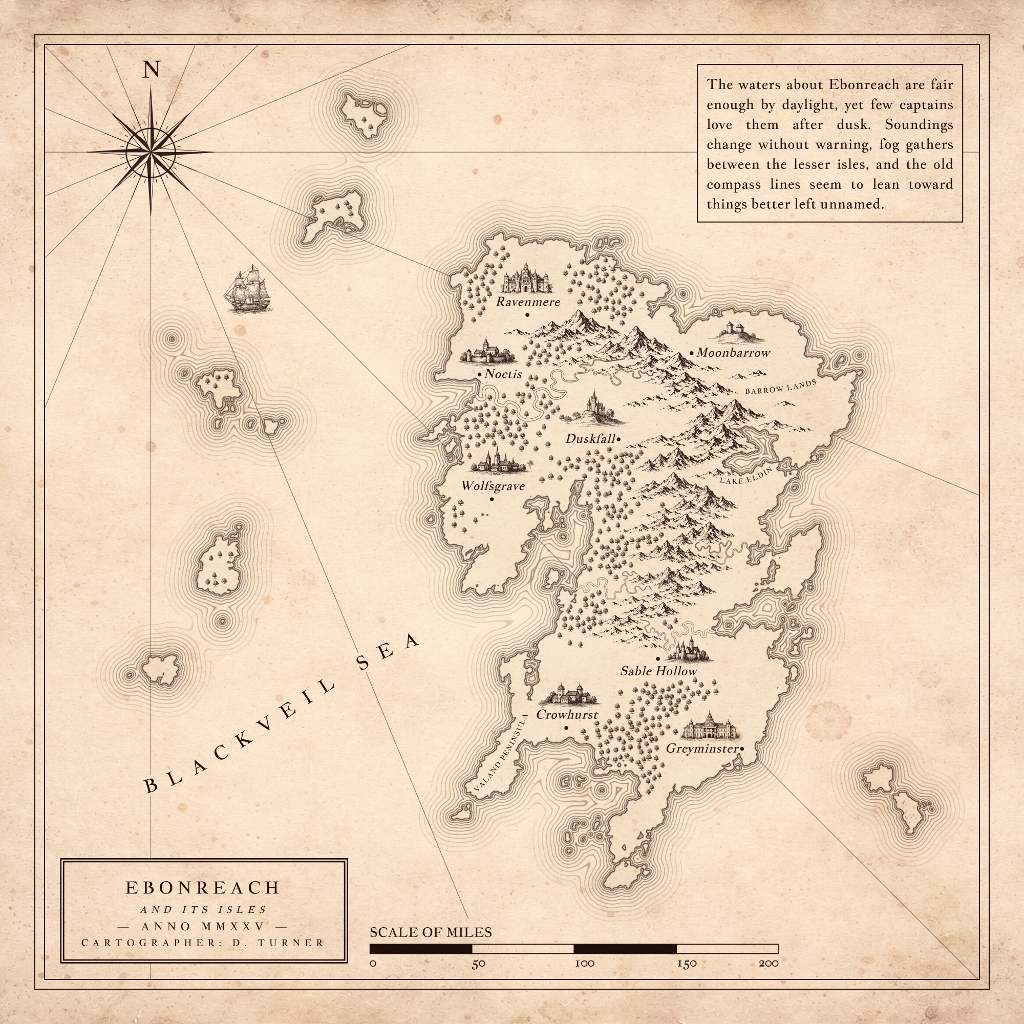
When you're deep into building a fantasy world, writing a novel, or running a tabletop campaign, your geography is going to change. A new chapter demands a mountain pass you didn't plan for. A D&D party completely bypasses your main city and sails across the western sea.
Most fantasy map makers force you into a rigid box. You bake a static background image, flatten the landmass, and spend hours placing assets. If your story changes later, your choices are frustrating: live with an inaccurate map, or throw away your hours of hard work and rebuild the image from scratch.
Nova Terra is built entirely around an editable project workflow. It treats your map as a fluid canvas that can change right alongside your writing.
The Problem With Flat Backgrounds
Traditional map software treats your land as an unchangeable art layer. Once it's drawn, it's locked. Nova Terra keeps every single element separate and interactive. Because your world data is saved in a live local file, you can reshape coastlines, move a mountain range, or shift an entire empire's borders fifty hours into a project without breaking your layout.
The program bridges the gap between raw procedural generation and manual artistry. You get a powerful set of tools that feel intuitive to use, but keep the underlying world-building logic connected.
A Simple, Three-Step Fantasy Workflow
Building a stunning world map doesn't require complex graphic design skills. Nova Terra organizes the process into a natural, layer-based workflow:
1. Sculpt Your Coastlines First
Start by using procedural generation to roll unique, organic landmasses, adjusting parameters like roughness or moisture bias to fit your setting. If you already have a loose sketch of your world, you can upload it as an adjustable reference image overlay and trace right over it. Use the manual land draw and erase tools to refine your islands and continents until the broad silhouette looks exactly right.
2. Populate the Setting Dynamically
Once your landmass is established, begin dropping in rivers, roads, and settlements. Nova Terra features vector-based pathways, meaning you can grab an entire trade route or river course and stretch, bend, or move it dynamically.
As you place settlements, you can type your own names or toggle culture-based generators to populate the map quickly. Right-clicking any settlement opens a deep lore ledger where you can record population stats, ruling factions, and local hazards directly within the map project file.
3. Apply an Antique Atlas Finish
With the geography locked down, you can polish the map using a massive library of over 1,100 high-resolution, hand-drawn map symbols. Drop down mountains, forests, castles, and sea monsters to give the workspace a classic cartographic look.
Finally, customize your canvas with authentic paper textures, ocean dot patterns, decorative title blocks, and dynamic legends to make the map look print-ready.
Scale That Operates on Real Logic
One of Nova Terra's most powerful features is its scale-aware engine. Scale isn't just a dummy graphic you slap in the corner. When you set your map span, the program locks that distance into the workspace.
Using the built-in path measurement tool, you can trace a winding road across your kingdom to instantly calculate exactly how far it is. Even better, you can input travel settings, like traveling on horseback via dirt roads for 8 hours a day, and the program will automatically tell you how many travel days it will take your characters to reach their destination. Your world's scale remains perfectly consistent, ensuring your manuscript's travel logic matches the map.
Total Creative Privacy
Nova Terra doesn't require you to sign up for a subscription, make an account, or upload your proprietary world-building data to a cloud server. It runs entirely locally in your web browser. Your maps are your own, saved directly to your computer as lightweight project files, and final renders can be exported as high-resolution PNGs whenever you're ready to share them.