
Cartography isn't just for fictional realms. Whether you are mapping a historical military campaign, illustrating a travel memoir, recreating an ancient atlas, or building an alternate-history setting, accuracy is everything. You can't just guess where a coastline bends or where a major city sits.
Most fantasy map editors make tracing real-world geography incredibly tedious, forcing you to painstakingly click out every single peninsula by hand.
Nova Terra bridges the gap between historical data and beautiful vintage aesthetics. Using landmask import and reference tools, you can transform real-world geographic data into a customizable atlas page in a matter of minutes.
Step 1: Instantly Generate Perfect Real-World Coastlines
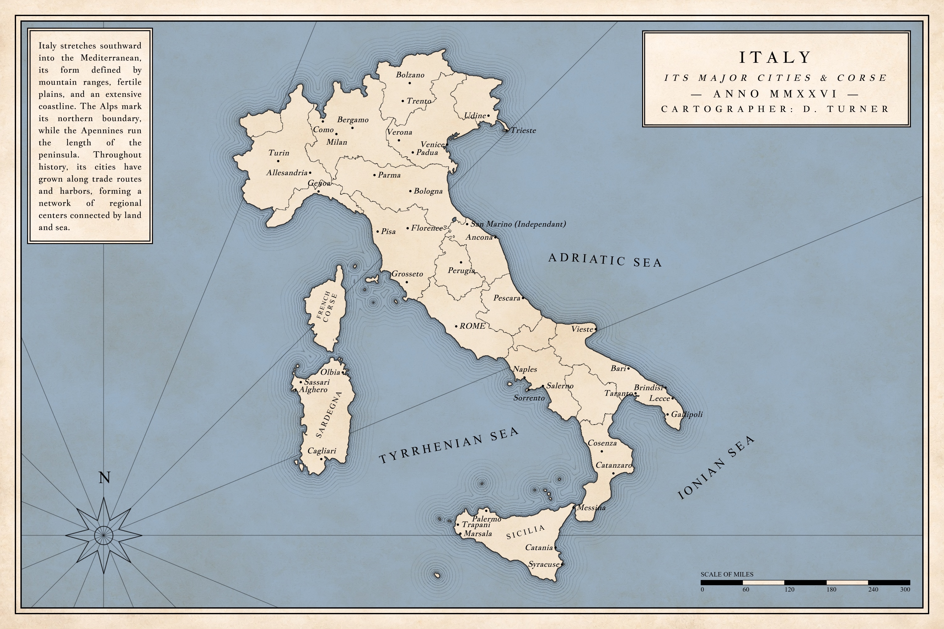
You don't need to hand-draw the complex coastlines of the Mediterranean. To create this map of Italy, the process started outside the app: download a standard black-and-white shape or outline of the country.
By loading that image directly into Nova Terra's Landmask Image Import tool, the engine reads the contrast and generates an editable coastline foundation based on the silhouette. You get a highly detailed geographic starting point in a single click, bypassing hours of manual tracing.
Step 2: Scale the Map to the Real World
Once your landmass is loaded, you need the math to match reality. In Nova Terra, scale isn't an afterthought or a static sticker.
By inputting the true global map span into the project settings, the engine locks real-world dimensions directly into the workspace logic. The Scale Bar Editor updates itself to match, ensuring that measured screen distance translates cleanly to real-world miles or kilometers. This makes grid layouts, route planning, and distance measurements historically accurate.
Step 3: Batch-Import Labels and Align with Precision
Placing dozens of major cities click-by-click is a workflow of the past. Nova Terra allows you to use your preferred AI assistant to generate a comma-separated list of the historical or modern cities you need.
Using the Batch Labels tool, copy and paste that list to drop every city name onto the canvas at once. To guarantee precise placement, toggle the Reference Image Overlay feature. By uploading a real geographic map, setting it to a low opacity, and locking it over your canvas, you can drag your batch-imported city names into their exact real-world positions with clean visual alignment.
Step 4: Apply a Minimalist, Antique Finish
Real-world historical maps thrive on clean presentation and elegant linework. Nova Terra's universal ink color system and layered finish options let you dial back the fantasy clutter to achieve a sophisticated atlas style.
Clean Border Linework
Accentuate the imported landmask with ocean echo lines and sharp coastal trims.
Draggable Presentation Blocks
Drop a structured text block on the left for historical context, place a decorative compass rose in open sea space, and configure a formal Title Block to label the project.
Timeless Textures
Layer a subtle paper texture over the canvas to give the final piece a crafted, archival quality.
When your layout is complete, export a crisp, double-resolution PNG that is ready for print layouts, academic presentations, or digital publication.